Walking Is Not How You Get Around These Cities. It's How You Understand Them.
Destination: Europe
Category: variant
There is a standard version of the walkable European city list. It ranks cities by sidewalk width, by the percentage of streets closed to cars, by the density of pedestrian crossings. Amsterdam scores highest. Copenhagen follows. Seville and Valencia appear because their historic centers are compact. The list is accurate. It is also measuring the wrong thing.
Those rankings measure the absence of obstacles. They tell you where walking is easiest. They do not tell you where walking is most necessary — where the act of walking is not a mode of transit between named attractions but the only method by which the city reveals what it actually is.
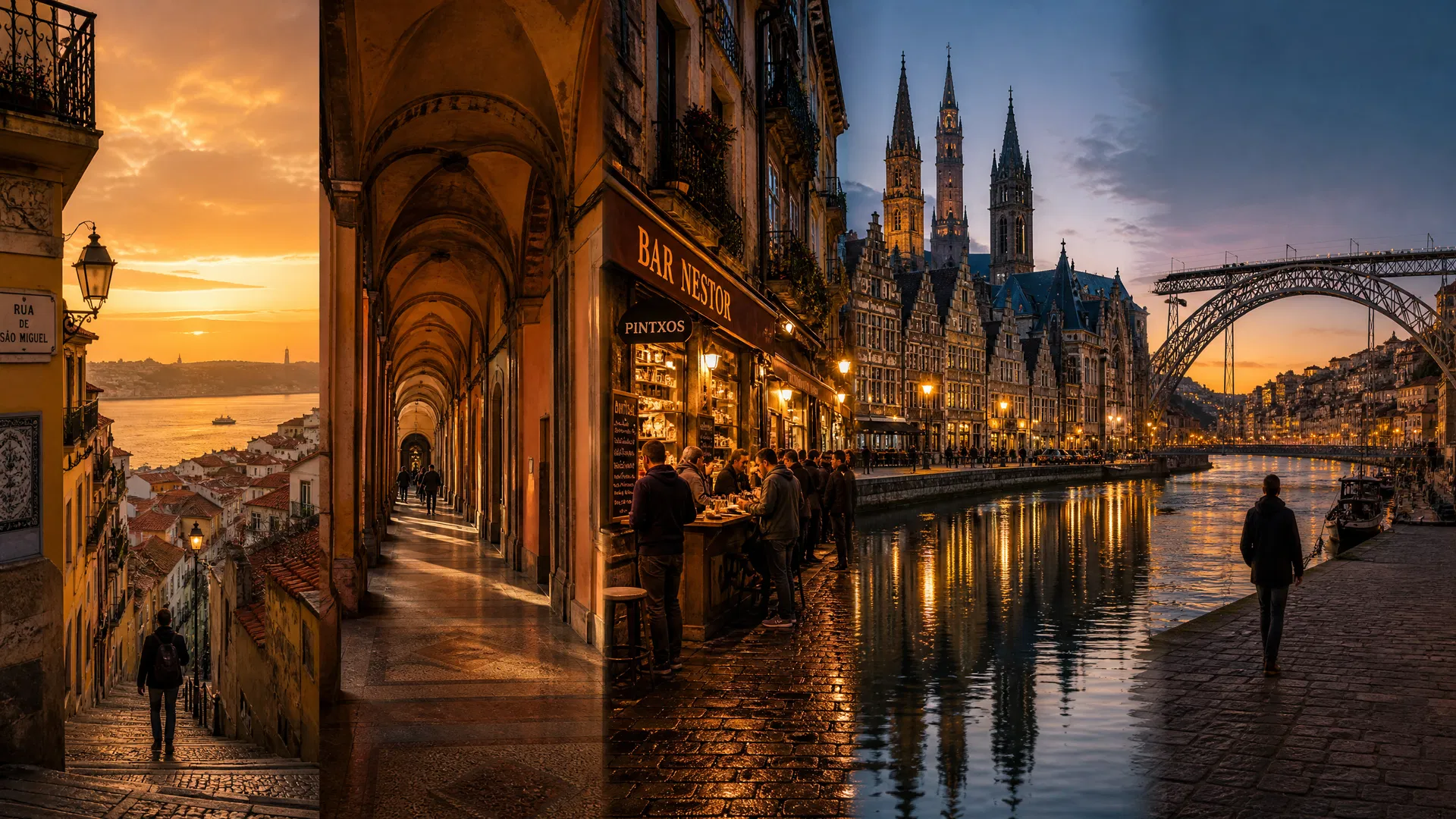
The cities on this list are not here because they are easy to walk. Several of them are genuinely difficult to walk — Lisbon and Porto are built on granite hills that will work your legs in ways that flat cities don't. They are here because walking is the only way to understand them. The elevation change is the information. The covered portico is the argument. The bar counter is the decision. The medieval lane is the history lesson that no museum can replicate because you are inside it, not looking at it through glass.
This is the distinction that every competitor post on European walkability misses, and it produces three consistent errors. The infrastructure mistake: ranking cities by pedestrian infrastructure quality rather than by the reward that walking produces. The flatness mistake: favoring flat cities because flat cities are easier to walk, when the most interesting walking cities in Europe are often the hilliest ones — because the elevation change is the content. The attraction-to-attraction mistake: describing walking as the mode of transit between named sights, when the walk between attractions is itself the attraction — the specific corner in the Alfama, the specific portico transition in Bologna, the specific pintxos decision at each San Sebastián bar counter.
The six cities below correct all three errors. Each one earns its place on this list not because it is pleasant to walk but because it is impossible to understand any other way.
Lisbon: The City That Makes You Earn Every View
The thesis of walking in Lisbon is not comfort. Lisbon is built on seven hills — the Alfama, the Mouraria, the Bairro Alto, the Príncipe Real, the Estrela, the Graça, the Penha de França — and the city's topography is not incidental to its character. It is its character. The specific experience of climbing the Alfama's Rua de São Tomé toward the Miradouro da Graça and arriving at the viewpoint after fifteen minutes of cobblestoned ascent is not a scenic detour. It is the only way to understand why Lisbon was built the way it was — why the Moorish quarter occupies the highest ground, why the Pombaline grid sits in the valley below, why the river is visible from every elevated point in the city. The view is earned. The earning is the lesson.
The Alfama is the oldest continuously inhabited neighborhood in Lisbon, and it is not walkable in the way that a flat city center is walkable. It is walkable in the way that a medieval hill town is walkable — which means that every street decision is a commitment, that dead ends are common, and that getting lost is not a failure of navigation but a feature of the neighborhood's design. The Alfama was built to be confusing to outsiders. Walking it until it stops being confusing is the only way to understand why the Moorish city was organized around defensibility rather than efficiency. The specific moment when the Alfama stops feeling like a maze and starts feeling like a logic — when you understand that the streets run along the hill's contours rather than against them — is a moment that no guided tour produces. It requires the accumulated confusion of having walked it wrong several times first.
The Bairro Alto operates on a different logic. Where the Alfama is medieval and organic, the Bairro Alto is 16th-century planned — a grid of narrow streets on the western hill that was Lisbon's first purpose-built residential expansion after the Reconquista. The specific walking circuit through the Bairro Alto at 11am, before the neighborhood's bars and restaurants open for the evening, reveals a neighborhood that is genuinely quiet — a residential grid of laundry lines and corner groceries and elderly residents who have lived in the same apartment for forty years. The evening Bairro Alto, the one that appears in travel content, is a performance. The morning Bairro Alto is the city itself.
The Miradouro de Santa Catarina is the correct viewpoint for understanding Lisbon's relationship to the Tagus. Not the Miradouro da Graça, which looks east over the Alfama, and not the Miradouro de São Pedro de Alcântara, which looks east over the Baixa — but Santa Catarina, which looks south and west over the river's widest point, where the Tagus is wide enough to be mistaken for the sea. The specific light at Santa Catarina at 6pm in autumn, when the sun is low over the Setúbal peninsula across the water, produces a color on the river that no photograph captures accurately because the color is partly in the air rather than on the surface. This is a view that requires being present at the correct time of day, which requires the kind of unhurried walking schedule that Lisbon rewards and that itinerary-driven tourism prevents.
For visitors planning time in Lisbon, the Lisbon 5-day travel guide covers the city's neighborhoods in sequence, and the Lisbon solo travel guide maps the Alfama walking circuit in detail. The Lisbon budget guide is particularly useful for the walking-focused traveler because Lisbon's best experiences — the miradouros, the neighborhood streets, the tram routes — are either free or very cheap.
Bologna: Where Lisbon's Hills Become Covered Arcades
Where Lisbon rewards the walker who commits to elevation, Bologna offers something that Lisbon's hills make impossible: the covered walk. Bologna's 40 kilometers of portici — the covered arcades that line the city's streets and connect its neighborhoods — are the most sophisticated pedestrian infrastructure in Europe, and they are not infrastructure in the modern sense. They are architecture with a social argument. The portici were built over six centuries, beginning in the 12th century when the University of Bologna — the oldest university in the Western world — needed to house its students, and the solution was to extend the upper floors of buildings over the street to create covered ground-floor space. The arcade was the result. The city's walking culture is the consequence.
The specific experience of walking Bologna's portici in rain is the experience that makes the city's architecture legible in a way that fair-weather walking doesn't. When it rains in Bologna, the city continues. The covered streets mean that the transition between indoors and outdoors is not a binary choice but a gradient — you can walk from the Piazza Maggiore to the Mercato di Mezzo to the university quarter to the Quadrilatero market without ever being fully exposed to the weather. The portici are not a convenience. They are an argument about what a city owes its pedestrians — not just the absence of cars but the presence of shelter, of shade in summer, of dryness in rain, of a covered public space that belongs to everyone.
The Portico di San Luca is the most famous of Bologna's covered walks and the most specific demonstration of the city's thesis. The 3.8-kilometer portico climbs from the Porta Saragozza at the city's edge to the Santuario della Madonna di San Luca on the Colle della Guardia above the city — 666 arches, each one numbered, each one part of a continuous covered structure that has been maintained without interruption since 1674. The walk takes approximately 90 minutes at a comfortable pace. The first 20 minutes are flat, through the residential streets of the Colle Ameno neighborhood. The middle section climbs steadily through the hills. The final approach to the sanctuary is steep. At the top, the view over Bologna — the red-tiled roofscape, the two medieval towers, the Po Valley extending north to the Alps — is the view that the city has been building toward for the entire walk. The portico is not a scenic route to a viewpoint. It is a covered argument about the relationship between effort and reward.
The Quadrilatero market, the medieval market quarter between the Piazza Maggiore and the Via Rizzoli, operates on a different timescale than the portico. The Quadrilatero is Bologna's daily food market — the specific concentration of salumerias, fishmongers, cheese shops, and produce stalls that has occupied the same streets since the medieval period. The correct time to walk it is 9am, when the stalls are fully stocked and the neighborhood's residents are doing their daily shopping rather than the tourists who arrive after 10. The specific smell of the Quadrilatero at 9am — the combination of aged Parmigiano-Reggiano from the cheese counters, the fresh pasta from the pasta shops, the cured meats from the salumerias — is the smell of a city that takes food seriously enough to organize its urban geography around it.
The Bologna 4-day food guide covers the Quadrilatero market circuit and the Portico di San Luca walk in detail, including the specific timing for each.
Ljubljana: Where Bologna's Scale Becomes Something You Can Hold
Where Bologna shelters the walker under 40 kilometers of covered arcade, Ljubljana offers something that Bologna's size makes impossible: completeness. Ljubljana is the capital of Slovenia and one of the smallest capital cities in Europe, with a historic center that can be walked end-to-end in under 20 minutes. This is not a limitation. It is the city's specific gift to the walker who has spent time in cities where the interesting neighborhoods are separated by long stretches of urban nothing — where the walk between the old town and the creative district requires passing through a kilometer of banks and chain restaurants. In Ljubljana, there is no such stretch. The medieval castle hill, the Baroque old town, the Art Nouveau quarter, the covered market, and the contemporary Metelkova cultural district are all within a 15-minute walk of each other, and the transitions between them are as interesting as the destinations themselves.
The Ljubljana Castle is the correct starting point for understanding the city's geography, and the correct approach is on foot from the old town rather than by funicular. The path up through the Stari Grad neighborhood — the medieval quarter that climbs the castle hill through a series of narrow lanes and stairways — takes approximately 20 minutes from the Triple Bridge at the city center. The ascent passes through a residential neighborhood that is genuinely inhabited rather than tourist-facing: the specific combination of Ljubljana's medieval street grid with its contemporary residents — the residents who have lived in the castle hill neighborhood for generations and who navigate the same stairways daily — produces the specific texture of a city that has not been museumified. The castle hill is not a preserved historic district. It is a neighborhood that happens to have a medieval castle at the top.
The Ljubljanica River walk is the city's central pedestrian axis, and it operates differently from the castle hill walk. Where the castle climb is effort and reward, the river walk is horizontal and unhurried — the specific pleasure of a city that has organized its public life along a waterway. The stretch from the Triple Bridge to the Dragon Bridge, approximately 500 meters, passes through the city's outdoor café culture, its weekend market, and its most photographed facades. The stretch beyond the Dragon Bridge, continuing north toward the Metelkova district, passes through a neighborhood that most visitors don't reach — the specific transition from the Baroque city center to the 19th-century residential grid that precedes the former Yugoslav military barracks that became Metelkova.
Metelkova is Ljubljana's most specific competitive gap detail. The former military compound was occupied by artists and activists in 1993 after the Yugoslav National Army withdrew from Slovenia, and it has operated as an autonomous cultural center since then. The specific walking circuit through Metelkova's courtyards — the murals, the alternative venues, the specific combination of decay and creativity that characterizes a genuinely occupied rather than designed cultural space — is a 30-minute walk from the old town that most Ljubljana itineraries don't include. It is the walk that distinguishes a Ljubljana visit from a Ljubljana tourist experience.
The Ljubljana 3-day itinerary covers the castle approach and the Metelkova circuit, and the Ljubljana family guide is useful for the specific detail that Ljubljana's car-free old town makes it one of the most manageable European capitals for walking with children.
San Sebastián: Where Ljubljana's Completeness Becomes a Culinary Circuit
Where Ljubljana suffices — where the city's small scale produces a completeness that larger cities can't achieve — San Sebastián feeds. The Basque city on Spain's northern coast has a specific relationship between walking and eating that no other city in Europe replicates: the txikiteo, the practice of moving from bar to bar through the Parte Vieja eating pintxos at each counter, is not a food tour. It is the city's primary social architecture. The Parte Vieja — the old town quarter bounded by the Río Urumea, the Concha bay, and the Monte Urgull — contains the highest concentration of Michelin-starred restaurants per capita of any city in the world. But the txikiteo is not about the starred restaurants. It is about the counter culture of the unstarred bars, where the pintxos are assembled fresh each morning and where the correct approach is to arrive, assess what's on the counter, order two or three pieces with a glass of txakoli or a small beer, eat standing at the counter, and move to the next bar.
The specific walking circuit of the Parte Vieja for the txikiteo begins at the Calle de la 31 de Agosto, the street that runs along the old town's northern edge near the Monte Urgull, and works south through the grid toward the Calle Mayor. The circuit covers approximately 1.5 kilometers and passes through the highest density of pintxos bars in the old town. The correct time is 7pm to 9pm, when the bars are at their fullest and the pintxos are freshest. The specific bars that the txikiteo circuit passes through — Bar Txepetxa for the anchovy pintxos, La Cuchara de San Telmo for the hot pintxos that require ordering from the kitchen rather than selecting from the counter, Bar Zeruko for the contemporary pintxos that apply fine-dining technique to the counter format — are not destinations on a food tour. They are stops on a walking circuit where the walk is the structure and the eating is the content.
The Monte Urgull walk is San Sebastián's most specific competitive gap detail. The hill that rises above the Parte Vieja on the city's northern edge is topped by a 19th-century fortification and a large statue of Christ — the Sagrado Corazón — that is visible from the Concha beach below. The walk to the top takes approximately 25 minutes from the old town through a series of paths that wind through the hill's wooded slopes. At the top, the view encompasses the Concha bay, the Isla de Santa Clara in the bay's center, the Monte Igueldo on the bay's western headland, and the Cantabrian Sea extending north. The specific detail that the Monte Urgull walk reveals is the relationship between the city's geography and its food culture: the Concha bay's protected arc, which gives the city its beach, also creates the specific microclimate that makes the Basque Country's agricultural hinterland — the txakoli vineyards, the cider orchards, the fishing ports — productive in a way that the exposed Atlantic coast to the north is not. The walk teaches you why the food is the way it is.
The Paseo Nuevo, the coastal walk that runs along the city's northern edge between the Monte Urgull and the Zurriola beach, is the walk that most visitors miss. The Paseo de la Concha — the promenade along the Concha bay — is the famous walk, the one that appears in every San Sebastián photograph. The Paseo Nuevo is the walk on the other side of the Monte Urgull, exposed to the open sea rather than the protected bay. The specific experience of the Paseo Nuevo in autumn, when the Cantabrian swells produce waves that break against the seawall and send spray across the path, is the experience that explains why the Basque Country's relationship to the sea is different from the Mediterranean relationship — more confrontational, more elemental, more present in the daily life of the city.
The San Sebastián 4-day food guide covers the txikiteo circuit in detail, including the specific bars and the correct timing for each stop. The San Sebastián food and couples guide adds the Monte Urgull walk and the Paseo Nuevo to the itinerary.
Ghent: Where San Sebastián's Culinary Walk Becomes Medieval Persistence
Where San Sebastián feeds — where the walk is structured around the bar counter and the pintxos decision — Ghent persists. The Belgian city on the Lys and Scheldt rivers is the most underestimated medieval city in Western Europe, and its underestimation is the result of a specific geographical accident: it sits between Bruges and Brussels, and travelers who are making a single stop in Belgium almost always choose one of those two cities. Bruges is smaller and more immediately photogenic. Brussels is the capital. Ghent is the city that rewards the traveler who has already been to both and is ready for something that neither of them offers: a medieval city that is also a contemporary university city, where the 13th-century guild houses on the Graslei waterfront are 200 meters from the bars and music venues of the student quarter, and where the walk between them passes through a city that has been continuously inhabited and continuously relevant for 800 years.
The three towers of Ghent's medieval skyline — the Sint-Baafskathedraal, the Sint-Niklaaskerk, and the Belfort — are the city's primary visual argument, and they are best understood by walking the axis between them rather than visiting each one individually. The three towers were built in proximity to each other as simultaneous demonstrations of civic, religious, and commercial power: the Belfort is the city's commercial tower, built by the guilds to house the city's privileges charter and to ring the bells that regulated the working day; the Sint-Niklaaskerk is the merchants' church, built by the same guilds that built the Belfort; the Sint-Baafskathedraal is the bishop's church, built to assert ecclesiastical authority over the commercial city below. The specific view from the Belfort's upper gallery is the only vantage point from which all three towers are visible simultaneously — a view that makes the medieval power competition between civic, commercial, and religious authority legible in a way that no museum explanation achieves.
The Patershol neighborhood is the specific Ghent detail that most travel content misses. The medieval quarter north of the Gravensteen castle — the 12th-century fortress that is the best-preserved medieval castle in the Low Countries — is a network of narrow lanes and small squares that was Ghent's leather-working district in the medieval period and that is now the city's most concentrated restaurant neighborhood. The correct time to walk the Patershol is 8am, before the restaurants open for lunch service, when the neighborhood's restaurant workers take their pre-service walks through the medieval lanes and the Kraanlei waterfront — the most photographed street in the Patershol — is empty of tourists. The specific combination of the Kraanlei's guild house facades reflected in the Lys at 8am, before the tour groups arrive from the city's hotels, is the Ghent photograph that the travel content doesn't show because it requires being there at the wrong time for tourism and the right time for the city.
The Dok Noord neighborhood is the competitive gap detail that separates a Ghent visit from a Ghent tourist experience. The former industrial port on the city's northern edge has been converted into Ghent's creative district — a specific combination of repurposed warehouses, contemporary cultural spaces, and independent food and drink venues that occupies the landscape of the city's 19th-century industrial expansion. The 20-minute walk from the Gravensteen through the 19th-century industrial landscape to Dok Noord is the most compressed urban history walk in Belgium: in 20 minutes, you pass through 800 years of Ghent's economic history, from the medieval castle that controlled the river trade, through the guild house waterfront that organized the cloth trade, through the 19th-century industrial port that organized the coal and textile trade, to the contemporary creative district that has organized itself in the ruins of the industrial economy.
The Ghent 3-day guide covers the three towers walk and the Patershol circuit. The Ghent solo guide includes the Dok Noord walk and the Belfort gallery visit. The Ghent family guide maps the Gravensteen approach and the Kraanlei waterfront in detail.
Porto: Where Ghent's Medieval Persistence Becomes Topographic Reward
Where Ghent persists — where the city's 800 years of continuous relevance is the argument — Porto rewards. The reward is specific and requires earning. Porto is built on the north bank of the Douro in a way that makes the city's topography impossible to ignore: the combination of granite hills, river gorge, and medieval street grid produces a walking experience where every viewpoint requires elevation change, and where the elevation change is itself the information. The Miradouro da Vitória. The Jardim das Virtudes. The Serra do Pilar across the river in Vila Nova de Gaia. None of these views are accessible by car, by tram, or by convenience. They are accessible by the specific commitment to walking up that Porto's geography requires. In return for that commitment, Porto offers the specific satisfaction of a view understood rather than consumed — a view the walker has earned by understanding, through the elevation change itself, exactly how the city is arranged around the river.
The Ribeira to Foz walk is Porto's most specific competitive gap detail and the walk that most Porto itineraries don't include because it requires four kilometers of commitment along the Douro's north bank. The Ribeira is Porto's medieval waterfront district — the specific concentration of azulejo-tiled facades, wine lodges, and riverside restaurants that is the city's most photographed neighborhood. The Foz do Douro is the neighborhood at the river's mouth, where the Douro meets the Atlantic. The walk between them follows the river's north bank through a sequence of neighborhoods that compress Porto's urban history into a single linear route: the medieval Ribeira, the 19th-century Miragaia, the early 20th-century Massarelos, the mid-century Lordelo do Ouro, and finally the contemporary Foz. At the Passeio Alegre garden at Foz, where the river meets the sea, the specific Atlantic light at the river mouth — the combination of the river's brown water meeting the Atlantic's grey-green, the specific quality of the light at the junction of river and sea — produces a color that the river's interior stretches don't achieve. This is the walk's reward, and it is not available by any other means.
The Cedofeita neighborhood is Porto's most underrepresented creative district. The neighborhood west of the historic center — the specific Rua de Miguel Bombarda gallery strip where Porto's contemporary art spaces are concentrated — operates on a Saturday afternoon walking culture when the neighborhood's creative community is most visible. The specific combination of the gallery openings, the independent bookshops, and the natural wine bars that line the Rua de Miguel Bombarda on Saturday afternoons is the Porto experience that the city's wine-and-azulejo tourism narrative doesn't include. It is the walk that reveals Porto as a contemporary city rather than a preserved one.
The São Bento station approach is the specific detail that separates a Porto walk from a Porto tourist experience. The correct approach to the station is not through the main entrance on the Praça Almeida Garrett but from the Praça da Batalha, two blocks east — the approach that allows the station's exterior, a 1916 Beaux-Arts building, to be comprehended before the interior's 20,000 azulejo tile panels are revealed. The tile narrative, designed by Jorge Colaço between 1905 and 1916, documents Portuguese history in a sequence of panels that rewards the walker who arrives with enough time to read it section by section rather than photograph it as a single image. The panels depicting the Battle of Valdevez in 1140 and the entry of João I into Porto in 1387 are at eye level on the station's north wall. The panels depicting the history of transportation — the ox carts, the boats, the early trains — are on the south wall. The station is not a tourist attraction. It is a history lesson organized as a room.
The Porto 4-day itinerary covers the Ribeira to Foz walk and the São Bento approach. The Porto solo guide maps the Cedofeita gallery circuit. The Porto food guide includes the specific timing for the Ribeira waterfront and the Mercado do Bolhão.
Why Amsterdam, Paris, and Prague Don't Appear on This List
Every walkable European cities list includes Amsterdam. Many include Paris. Several include Prague. None of them appear here, and the reasons are specific rather than dismissive.
Amsterdam is consistently ranked the most walkable city in Europe by infrastructure metrics and is genuinely pleasant to walk. The canal ring, the flat topography, the density of the historic center — these produce a walking experience that is efficient, comfortable, and aesthetically rewarding. Amsterdam doesn't appear here because the city's flatness and its canal grid produce a specific walking experience where the walk is efficient rather than revelatory. Amsterdam is the city that is easiest to walk. It is not the city where walking is most necessary to understanding. You can understand Amsterdam from a bicycle, from a canal boat, from a café window. The city's logic — the concentric canal rings, the gabled facades, the bridge density — is legible from multiple vantage points and multiple modes. The cities on this list are not.
Paris is extraordinarily walkable and has its own destination post in the AskLeif library. It doesn't appear here because the Paris walk — the Haussmann boulevards, the Seine embankments, the arrondissement-hopping — is so thoroughly documented in existing travel content that including it would produce the least differentiated section in this post. Every walkable cities list includes Paris. This post's competitive gap is the argument for cities that produce equivalent walking rewards with a fraction of the existing content coverage. Paris is not absent because it doesn't belong on a walkable cities list. It is absent because it belongs on every walkable cities list, which is a different problem.
Prague is beautiful and genuinely rewarding to walk. It doesn't appear here because the Prague walking experience — the Charles Bridge, the Old Town Square, the Castle District — is organized primarily around the tourist circuit in a way that makes it difficult to walk productively off the obvious route. The cities on this list are walkable in all directions. Prague is walkable along specific paths. The Žižkov neighborhood, the Vinohrady district, the Holešovice quarter — these are rewarding to walk, but they require the traveler to already know that they exist and to have made a deliberate decision to leave the tourist circuit. The cities on this list reward the walker who simply walks. Prague rewards the walker who already knows where to go.
Planning: Choosing Your Walking City
The six cities on this list are not interchangeable. Each one rewards a specific kind of walking motivation, and the traveler who understands the distinction will have a more specific and more satisfying experience than the traveler who simply chooses the most popular option.
Choose Lisbon if your walking motivation is elevation and reward — if you want to earn your views and understand a city through the physical effort of climbing it. Lisbon requires comfortable shoes, a willingness to get lost in the Alfama, and enough time to walk the same neighborhood twice: once to get lost, once to understand the logic. Minimum useful time: four days. The Lisbon 5-day neighborhood guide is the correct starting point.
Choose Bologna if your walking motivation is shelter and food — if you want a city where the walk is covered and the destination is always a market, a restaurant, or a portico that leads to another portico. Bologna is the most comfortable walking city on this list in terms of weather protection, and the Portico di San Luca is the single most specific walking experience in Italy. Minimum useful time: three days. The Bologna portici and market guide covers the essential walking circuits.
Choose Ljubljana if your walking motivation is completeness — if you want a city that can be fully understood in a short visit, where the walk from the medieval castle to the contemporary cultural district takes 30 minutes and passes through every century of the city's history. Ljubljana is the correct choice for the traveler who wants depth without the logistical complexity of a large city. Minimum useful time: two days. The Ljubljana complete 3-day circuit is the correct starting point.
Choose San Sebastián if your walking motivation is culinary — if you want a city where the walk is structured around the bar counter and the food decision, where the txikiteo is the city's primary social architecture, and where the walk between bars is as important as the bars themselves. San Sebastián requires a willingness to eat standing up, to make decisions quickly at the counter, and to walk the same streets multiple times in the same evening. Minimum useful time: three days. The San Sebastián pintxos and txikiteo guide covers the txikiteo circuit in detail.
Choose Ghent if your walking motivation is medieval immersion — if you want a city where the 13th-century guild houses are 200 meters from the contemporary student bars, and where the walk between them passes through a city that has been continuously relevant for 800 years without becoming a museum. Ghent is the correct choice for the traveler who has already been to Bruges and wants the medieval city that Bruges would be if it were still alive. Minimum useful time: two to three days. The Ghent medieval walking guide covers the essential walking circuits.
Choose Porto if your walking motivation is topographic reward — if you want a city where the elevation change is the information, where every viewpoint is earned, and where the walk from the medieval waterfront to the river mouth teaches you the city's geography through the effort of covering it. Porto is the most physically demanding walking city on this list and the one that rewards the effort most specifically. Minimum useful time: three days. The Porto Douro and hills itinerary is the correct starting point.
Combining cities: Lisbon and Porto are the natural pairing — both Portuguese, both built on hills, both organized around water, but with entirely different walking characters. The Lisbon–Porto 7-day Portugal itinerary covers both cities in a single routing. Ghent and Bologna are the natural pairing for the traveler whose walking motivation is covered and sheltered — the portici of Bologna and the medieval arcades of Ghent are the two best answers in Europe to the question of what a city owes its pedestrians in bad weather. Ljubljana and San Sebastián are the natural pairing for the traveler who wants completeness and culinary depth — both cities are small enough to be fully understood in a short visit, and both reward the traveler who walks without an agenda.
Budget: All six cities are walkable on a modest daily budget. Lisbon and Porto are the most affordable of the six for accommodation and food. Bologna and San Sebastián are the most expensive, primarily because of the food culture — the Quadrilatero market and the txikiteo circuit both reward spending. Ghent and Ljubljana sit in the middle range. In all six cities, the walking itself is free, and the best experiences — the miradouros, the portici, the medieval lanes, the river walks — cost nothing.
When to go: All six cities are better for walking in autumn and spring than in summer. Lisbon and Porto in July and August are genuinely hot, and the cobblestone streets radiate heat in a way that makes afternoon walking uncomfortable. Bologna's portici provide shade but not cool air. San Sebastián's Parte Vieja in August is crowded enough that the txikiteo circuit loses its specific character — the counter culture requires space to operate. Ghent and Ljubljana are the most comfortable in summer of the six, but both are better in October when the tourist density drops and the city's own rhythms become visible. The September variant post covers the specific argument for autumn travel across Europe.
For any of these cities, AskLeif's itinerary generator builds a day-by-day walking plan tailored to your travel style, budget, and the specific neighborhoods you want to prioritize. The walking circuits described in this post are starting points. The generator turns them into a schedule.
The Walk Is Not How You Get There
There is a specific moment in every city on this list when the walk stops being transit and becomes understanding. In Lisbon, it is the moment when the Alfama stops feeling like a maze. In Bologna, it is the moment when you realize that the portico you are walking under was built in 1387 and has been sheltering pedestrians every day since. In Ljubljana, it is the moment when you look back from the castle hill and see the entire city laid out below you in a scale that a larger city would never permit. In San Sebastián, it is the moment when you understand that the txikiteo is not a food tour but a social architecture — that the bar counter is the city's primary public space. In Ghent, it is the moment when you look up from the Belfort gallery and see all three medieval towers simultaneously and understand why they were built in proximity to each other. In Porto, it is the moment when you arrive at the Foz do Douro after four kilometers of river walking and the Douro meets the Atlantic and the light changes.
None of these moments are available by any other means. Not by tram, not by taxi, not by guided tour. They are available only by walking — by the specific commitment to covering the distance on foot that each city requires. The cities on this list are not here because they are easy to walk. They are here because they are impossible to understand any other way.
Lisbon earns. Bologna shelters. Ljubljana suffices. San Sebastián feeds. Ghent persists. Porto rewards.