Island Hopping Is Not About the Islands. It Is About the Crossings.
Destination: Global
Category: comparison
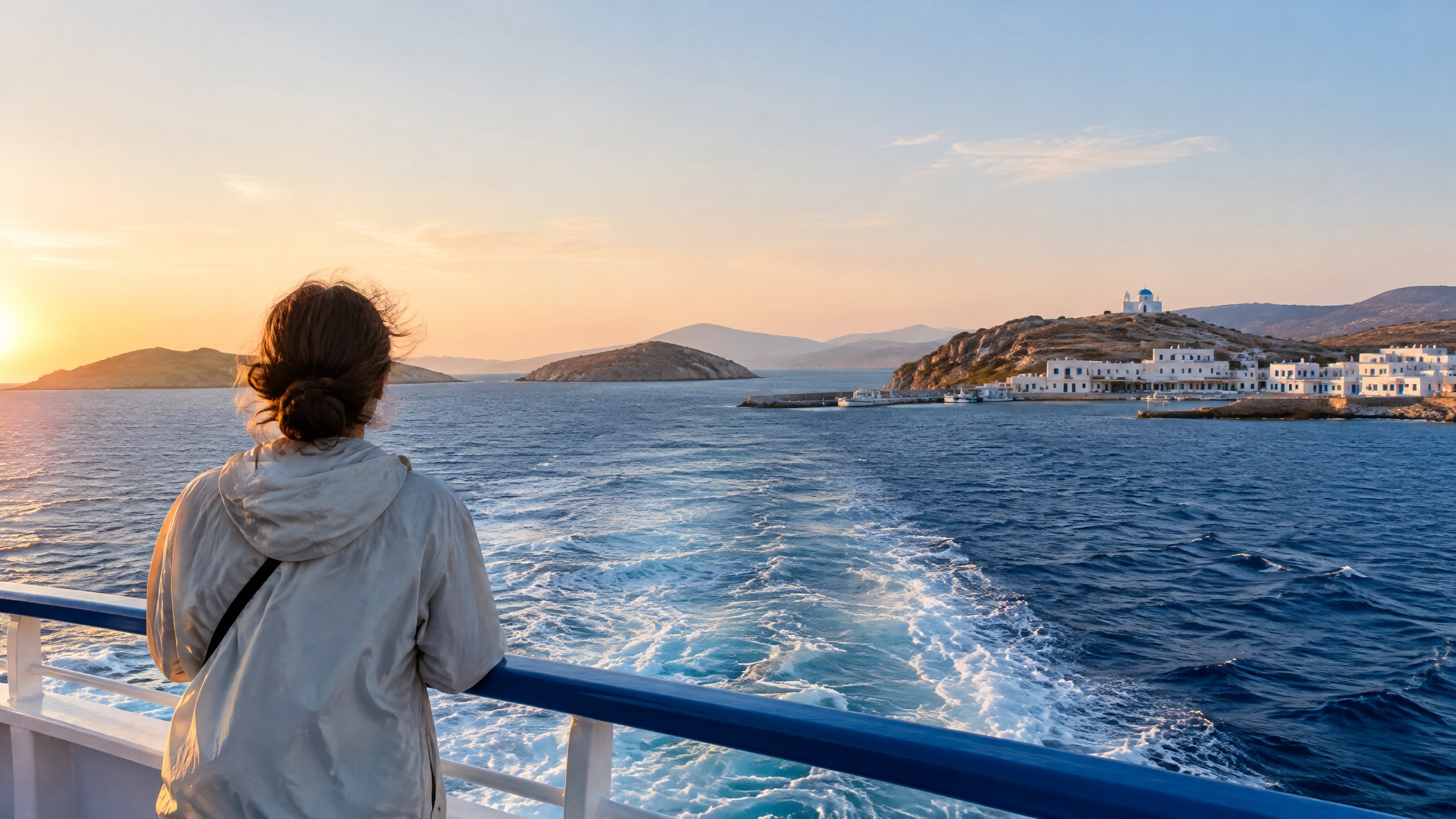
The Blue Star ferry leaves Piraeus long before the Cyclades look like islands. At first, there is only the low, industrial edge of Athens sliding behind the stern and a deck full of people arranging jackets against the wind. Then Paros appears as a pale line. A scooter rolls down the ramp. A family comes aboard with bakery boxes. For travelers looking for the best island hopping destinations, the arrival at Naxos teaches something a direct flight cannot: an archipelago is not a series of points on a map. It is a system in motion, held together by the crossings that let each island keep its own character.
Most island-hopping itineraries get this backward. They treat the sea as empty distance and the ferry, longtail, bangka, or liveaboard as a problem to solve quickly. The islands become a sequence of reservations; the movement between them becomes a timetable. That approach produces photographs, but it misses the accumulated understanding that makes an archipelago different from a beach holiday with several hotel keys.
The best island hopping destinations are the ones where each crossing changes the meaning of the island you just left and prepares you to read the next one. In the Cyclades, a slow ferry reveals how a shared visual vocabulary becomes radically different local lives. In the Philippines, a bangka route makes a country of 7,641 islands feel less like an inventory than an unfinished conversation. Croatia layers history at every harbor. Komodo lets biology alter the map. Thailand’s Andaman chain moves from infrastructure to limestone to a slower island rhythm. Scotland turns weather itself into the crossing’s subject. The journey is not how you get there. It is the trip.
That standard excludes three obvious candidates. The Maldives has extraordinary water and resort islands, but movement between atolls is often organized around private transfers between enclosed properties rather than an evolving relationship with a working archipelago. Hawaii rewards inter-island travel, yet its major-island experience is primarily structured by what each individual island contains—Haleakalā, Hawai‘i Volcanoes, the Nā Pali Coast—rather than by the crossings themselves. The Whitsundays offer serious sailing, but the charter is usually the central story. These six are here because the archipelago changes the traveler one crossing at a time.
What Makes the Best Island Hopping Destinations Different
A convincing island-hopping trip gives the traveler more than a better view from the water. The method of movement must carry information. A Greek ferry tells you which islands still depend on each other. A Philippine outrigger reveals the scale between populated shore and uninhabited limestone. A Croatian catamaran pulls Roman, Venetian, and Yugoslav-era ports into one line of sight. A Komodo liveaboard changes the time of day at which you reach an island. A Thai longtail makes a karst coastline legible at the speed of water. A CalMac crossing can turn a forecast into the day’s most important cultural fact.
The six destinations below have been chosen for six different dimensions of that idea. None is here because its beaches are better than every other beach. Each is here because the crossing teaches something the island alone cannot.
The Greek Cyclades: Where Each Island Answers the Same Question Differently
The Cyclades argue because the ferry makes it possible to see how one architectural language—white cubes, blue shutters, windmills, chapels—produces entirely different island lives. Santorini is vertical, compressed, and volcanic: houses stacked above the caldera, village paths built around the drama of the cliff, sunset crowds moving toward the same western edge. Naxos is broad enough to grow food, quarry marble, and keep an interior that does not need the port to explain itself. Folegandros feels almost withheld, its Chora set high above the water and its small scale forcing the visitor to notice what an island does when spectacle is not the operating model.
That contrast is easiest to understand from the deck of a conventional Blue Star ferry, not a fast catamaran. The slow boat stops at smaller ports and gives the traveler time to watch the ferry’s social choreography: grocery crates loaded at Paros, hotel workers meeting arrivals, motorcycles balanced against the rail, teenagers leaving or returning for school and work. The boat is not a scenic delay between “real” places. It is the connective institution of the Cyclades.
A Greece islands itinerary through Athens, Santorini, and Mykonos supplies a useful framework for the first version of this route, but resist treating Santorini as the conclusion. It is the most extreme expression of the archipelago, not its summary. Let a Santorini five-day itinerary establish the caldera’s scale, then leave enough time to make the contrast visible: Naxos’s Portara at dusk, the marble villages around Apiranthos, and the green folds of an island that looks nothing like the Santorini most travelers imagined Greece to be.
Milos sharpens the geological argument. Sarakiniko’s white volcanic rock, Kleftiko’s sea caves, and the changeable color of the water make clear that Santorini’s eruption is one version of Cycladic geology, not the whole story. Use Naxos as the logistical hinge if the goal is depth rather than a frantic string of arrivals. The island’s port connections make it possible to treat the ferry schedule as an invitation to stay curious, not a spreadsheet to defeat. Choose the Cyclades over another Mediterranean chain when you want the individual islands to disagree with each other while speaking the same visual language.
The useful discipline is to leave one crossing unplanned. Stay on deck as the ferry arrives at an island you had not expected to know, watch who disembarks, and resist the instinct to turn every stop into an attraction. The Cyclades work because the ports make ordinary life visible: bakeries sending trays aboard, tradespeople traveling between islands, grandparents waiting by the ramp. That social traffic gives the white-and-blue aesthetic its human scale.
The Philippines: The Archipelago That Has Only Revealed a Fraction of Itself
Where the Cyclades make difference visible through a shared vocabulary, the Philippines reveals difference through scale: every crossing suggests how little of the country a single island can explain. There are 7,641 islands in the Philippine archipelago, but international travel tends to flatten that fact into a handful of familiar names—Palawan, Boracay, Siargao, Bohol. Island hopping here works when it moves beyond the assumption that the famous island is the destination and lets the water disclose the distance, weather, and local rhythm between places.
The El Nido-to-Coron route is the clearest version of that argument. A multi-day bangka journey through the Bacuit Archipelago and the Linapacan islands trades the speed of a direct transfer for a sequence of reef passages, beach camps, fishing villages, and mornings when the route is decided by water conditions. The essential detail is not the claim that one beach is clearer than another. It is waking after a night under a simple camp roof, packing a dry bag before daylight, and realizing that the boat crew’s knowledge of wind, tide, and anchorages is what made the map possible.
A Palawan adventure guide built around El Nido and Puerto Princesa gives the traveler a grounded entry point, while the Palawan couples itinerary can be adapted for a slower version of the same coast. Neither should persuade you to rush through Palawan as if it were one interchangeable tropical stop. El Nido’s limestone walls and Coron’s wreck-diving culture are linked by sea, but they do not offer the same question to a traveler.
Siargao offers another kind of crossing. Cloud 9 receives the headlines, but the nearby island circuit—Naked Island, Daku Island, and Guyam Island—shows how a surf destination can become a study in everyday movement. Habal-habal rides take people between coconut-land roads and small jetties; bangkas make the final short crossings. Daku’s food is often cooked and shared in a way that makes the day feel less like an excursion purchased from a desk and more like an island’s social geography briefly opened to a visitor. The northern frontier of Batanes offers an even sharper surprise: Ivatan stone houses, built for typhoon conditions, and sea crossings that make weather a planning fact rather than an aesthetic. Choose the Philippines when you want an archipelago to remain larger than the route you were able to take.
That scale should change how you book. A good route leaves buffer time for weather, uses crews with local knowledge rather than treating a boat as an interchangeable transfer, and gives the traveler permission to stop adding islands. The country’s value comes from knowing that the horizon contains far more than an itinerary can hold. In the Philippines, restraint is often the most intelligent form of ambition.
Croatia’s Dalmatian Coast: The Island Chain That Layers History at Every Port
If the Philippines reveals a geography that remains far larger than the traveler’s route, Croatia layers the route with every civilization that needed the Adriatic shoreline. The Dalmatian islands are not simply places between Split and Dubrovnik. They are ports whose harbor walls, fortifications, vineyards, fishing boats, and ferry slips carry Roman, Venetian, Austro-Hungarian, Yugoslav, and contemporary Croatian time at once.
Hvar is where many travelers begin and where many stop looking. Its Venetian fortress above Hvar Town and lavender fields in the interior appear to belong to different islands until you take the road toward Velo Grablje or Brusje and see how a maritime trading history and an agricultural one still occupy the same narrow land. In June, the lavender harvest and local distillation traditions give the island an inland season that ferry-only visitors miss. Vis gives the chain a different pressure. Closed as a Yugoslav military base until 1989, it kept a relative isolation that survives in the pace of Komiža’s fishing harbor and in the wreck-diving culture offshore.
A Croatia itinerary connecting Dubrovnik, Hvar, and Split helps establish the geography, but the route becomes more persuasive when you refuse to make every ferry an early-morning departure. Stay long enough in one port to understand why the next island feels different. A Dubrovnik travel guide that includes island hopping is useful for the southern anchor, especially when the old city makes clear how thoroughly the coast has been shaped by maritime power.
Korčula turns the argument toward a walled town that remains lived in rather than preserved as a set. Its Marco Polo origin story may be disputed, but the stronger reason to go is the stone street plan and the way local life still uses it after day visitors leave. Then there are the Kornati: a scatter of bare islands, islets, and reefs where a private charter or well-run excursion makes the absence of settlement the point. Croatia belongs on this list because a crossing from Hvar to Vis or Korčula is not a change of scenery. It is a change of historical layer.
Dalmatia also rewards arrivals made late enough to see the port reverse itself. Day boats unload, terrace tables begin to fill with residents rather than excursions, and the fortress or bell tower that looked ornamental from the water becomes part of an inhabited town. Build the route around two or three overnight ports rather than every island name you recognize. Croatia’s islands become legible when the ferry has time to deposit you into their evening rhythm.
Indonesia’s Komodo and Flores: The Island Chain Where Evolution Changed the Map
Where Croatia layers human history at every port, Komodo and Flores isolate a different history—the evolutionary one that can only be understood by moving through Wallacea island by island. The line Alfred Russel Wallace identified between Asian and Australian fauna becomes much more than a biogeography term when the route moves from Flores through Komodo National Park. Each crossing explains why the islands do not share the ecological assumptions of either mainland.
Labuan Bajo is the practical entry point, with the airport, harbor, dive operators, and provision shops that make movement possible. But the best version of this archipelago begins when it leaves the day-trip clock behind. An overnight liveaboard positions the boat before dawn at Padar, when the steep climb to the summit is still cool enough to make the three bays below feel earned rather than delivered. Their beaches carry different sand colors because the geology is different; the point is not to collect a familiar viewpoint but to see how a small island can hold several ecosystems in a single turn of the body.
The Komodo and Flores adventure guide is the necessary internal anchor for this route. Use it to plan the core sequence, then protect the night on the water that day trips cannot provide. Komodo and Rinca are not interchangeable dragon stops. Park rules, ranger guidance, season, trail conditions, and animal movement determine what access should look like, and a responsible itinerary lets those realities lead.
Flores widens the argument beyond the dragons. Kelimutu’s three crater lakes can appear in different colors because of mineral and volcanic conditions; the road to them passes through a longer island whose villages, volcanic slopes, and changing coast make Labuan Bajo feel like an entry rather than a complete destination. This is why the liveaboard matters. The movement from Flores to Padar, Komodo, Rinca, and back does not simply place more animals in front of the traveler. It produces a progressive understanding of isolation itself. Choose Komodo and Flores when island hopping needs to make geography feel like the force that created the trip.
The practical standard here is simple: pick the boat for its seamanship, crew, safety practices, and willingness to adapt to conditions, not its promise to fit every famous stop into one day. A responsible liveaboard leaves room for park restrictions, changing sea state, and the fact that wildlife does not arrive on a timetable. Komodo works when the boat is a way to participate in a protected geography, not a floating shortcut through it.
Thailand’s Andaman Chain: The Coastline That Changes Character at Longtail Speed
If Komodo isolates through deep biological time, Thailand’s Andaman chain reveals a living coastal sequence in which the longtail boat is the instrument that changes the scale. Phuket has airports, marinas, supply chains, and enough infrastructure to make an arrival feel almost urban. Move from there into the Phi Phi islands, then south to Koh Lanta and east toward Krabi’s caves, and the Thai island character shifts on every leg—from managed access, to limestone spectacle, to a slower local coastline, to water-cut rock that can only be reached by boat.
The longtail is not a decorative prop in this movement. Its shallow draft, open sides, and distinctive engine make the coastline readable. On a morning crossing from Ao Nang, you can see the karst rising directly from the water before Railay or Phra Nang becomes a beach name on an itinerary. From Phuket, a five-day couples island-hopping guide can make the gateway workable without allowing the logistics to become the story.
Phi Phi asks for particular discipline. The limestone walls and passages are real, but the island’s popularity can reduce the day to crowd avoidance if you arrive on the same timetable as every other boat. An overnight or an early-departure Koh Phi Phi island guide helps make the timing intentional. The more revealing contrast comes next: Koh Lanta’s longer beaches, Muslim fishing communities, and slower road rhythm shift the traveler away from Phi Phi’s concentrated harbor energy. The available Koh Lanta and Koh Tao island route is imperfect geographically—Koh Tao sits in the Gulf rather than the Andaman—but its Koh Lanta planning remains useful; keep the actual Andaman crossing sequence focused west of the peninsula.
Krabi completes the dimension. A Krabi island-hopping guide can help place sea caves, Railay, and the Phang Nga-facing karst within a route that begins with Phuket’s infrastructure but ends with limestone accessed at water level. Choose Thailand’s Andaman chain over a single Thai island when you want transport to reveal the coast progressively: ferry, longtail, harbor, beach road, cave mouth, then open water again.
The sequence works best when each stop is given a job. Phuket handles arrival and supplies. Phi Phi provides the concentrated limestone encounter. Koh Lanta lowers the tempo enough for the coastline’s working life to appear. Krabi turns the final crossings into approaches toward cliffs and caves rather than departures from a resort. That progression is precisely why the Andaman chain belongs here: the route changes its own atmosphere before it changes its geography.
The Scottish Islands: The Archipelago Where Weather Is the Crossing
Where Thailand’s Andaman chain lets the boat reveal rock and heat at close range, Scotland lets the crossing reveal weather as the archipelago’s central force. The Outer Hebrides, Skye, Mull, Staffa, and Orkney do not make sense as a sun-seeking version of island hopping. Their ferries, causeways, and small-airfield decisions are shaped by Atlantic wind, tide, visibility, and the fact that a changed forecast can alter the day’s logic without diminishing it.
The Outer Hebrides are the clearest expression. The Hebridean Way joins Vatersay to the Butt of Lewis through ferry legs, causeways, walking, and cycling, so the route progressively changes from southern machair to the peatier terrain of Lewis. Harris Tweed is not simply a souvenir in this context. It is legally required to be hand-woven by islanders in their homes in the Outer Hebrides, a material practice that makes the weather, wool, labor, and geography impossible to separate. A crossing here is an interval in which the traveler watches the next island emerge through rain, low light, or sudden blue rather than treating weather as a failed photograph.
AskLeif’s Isle of Skye adventure guide is the available anchor for a Scottish-islands trip and can form the first practical leg. It does not replace dedicated Outer Hebrides or Orkney coverage; those guide pages are still pending, and this article uses Skye under the explicitly authorized partial-guide exception. That limitation is worth naming because the route deserves an itinerary built around its actual crossings, not a generic Scottish road trip with ferries inserted afterward.
Mull and Staffa make the island logic more geological. Boats from Mull approach Fingal’s Cave on Staffa, where basalt columns turn a sea crossing into the only meaningful approach to the formation. Orkney takes the scale in another direction: ferries between Mainland, Hoy, and Westray connect Neolithic sites such as Skara Brae, the Ring of Brodgar, and Maeshowe with landscapes where settlement history is distributed across water. Scotland is here because it makes the traveler accept that conditions are not a nuisance placed between islands. Conditions are the experience that binds them.
Plan for that truth instead of trying to outsmart it. Leave a spare night before an international flight, carry a waterproof layer where it can be reached rather than packed away, and let a changed sailing become an invitation to walk a harbor, visit a weaving shed, or wait with people who have long known the difference between inconvenience and danger. Scottish island hopping is a lesson in attention because the weather keeps insisting that attention is practical.
How to Choose Among the Best Island Hopping Destinations
Choose the Cyclades if you want ferry travel to explain cultural variation within a shared architectural world. Seven to ten days gives the route enough space for Santorini’s drama, Naxos’s interior, and one smaller island without turning every port into a transit lounge. Choose the Philippines if you are willing to exchange predictability for the scale and weather-dependence of a larger archipelago. Give Palawan at least six to eight days if a multi-day boat route matters more than checking off El Nido and Coron separately.
Choose Croatia when history should accumulate at the harbor. A week can connect Split, Hvar, Vis or Korčula, and Dubrovnik, but choose fewer stops if you want the island differences to register. Choose Komodo and Flores if ecology is the point; five to seven days works best with at least one night on a liveaboard and time on Flores beyond Labuan Bajo. Respect park rules, operator safety standards, and seasonal sea conditions rather than forcing a fixed route.
Choose Thailand’s Andaman chain when you want the most approachable version of this thesis: Phuket makes arrival easy, then boats and ferries progressively change the coast’s scale. Eight to ten days allows Phuket, Phi Phi, Koh Lanta, and Krabi to feel like a sequence rather than a race. Choose the Scottish islands if you value weather, walking, craft, and historical landscape more than reliability of sun. Build extra buffer days; a disrupted crossing can be a planning inconvenience, but it can also be a reason to stay still long enough to understand the island you are on.
Budget follows the method of movement. Greece and Croatia reward a traveler who can work with public ferries and accept seasonal changes. The Philippines and Komodo require more attention to sea conditions, operator quality, dry-bag logistics, and overnight arrangements. Thailand offers the broadest range from public ferries to private longtails. Scotland rewards a flexible itinerary with a vehicle only where it is truly useful, a careful reading of CalMac schedules, and no expectation that the forecast will obey a plan. AskLeif can turn the crossings, buffers, and island sequence into a day-by-day itinerary so the trip retains the uncertainty that makes it meaningful without becoming chaotic.
The Crossings Make the Map
The Cyclades argue. The Philippines reveals. Croatia layers. Komodo isolates. Thailand shifts. Scotland weathers.
Those verbs are why these archipelagos belong together. Each tells the traveler that the sea between islands is not a blank space to erase as efficiently as possible. It is where the argument accumulates: shared architecture becomes contrast, scale becomes humility, history becomes visible, evolution becomes geography, a coastline changes character, and weather turns into culture.
An island can be extraordinary on its own. An archipelago becomes unforgettable when the next island changes the meaning of the last one.